
Tropical Cyclone Dineo Caught On Camera
Yesterday (February 13th) saw the fifth tropical cyclone of the Southern Indian Ocean season formed, and NASA’s Aqua satellite captured a visible image of the storm.
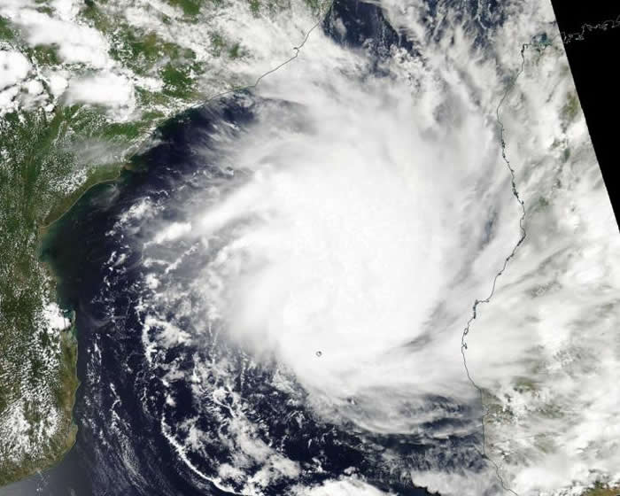
The Moderate Resolution Imaging Spectroradiometer or MODIS instrument aboard NASA’s Aqua satellite captured a visible image of newly developed Tropical Cyclone Dineo in the Mozambique Channel on February 13th, 2017.
Madagascar is to the east of the storm and Mozambique lies to the west. The image revealed strong storms around the center of circulation.

On February 13th at 10am, Dineo had maximum sustained winds near 46mph (40 knots/74 mph) that are expected to strengthen over the next two days. Dineo was located about 48 nautical miles north-northwest of Europa Island. Dineo was crawling to the south-southwest at 2.3mph (2 knots/3.7 kph).
The Joint Typhoon Warning Center noted that animated multispectral satellite imagery shows a consolidating low-level circulation center with deep convective banding (of thunderstorms) wrapping into the partially-exposed low-level center. The bulk of thunderstorms were over the eastern side of the storm.
In one and a half days, atmospheric conditions are expected to allow the system to turn westward to west-northwestward where it is forecast to make landfall along the east coast of Mozambique on February 16th.
More information: EurekAlert!