


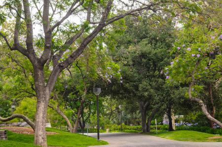
Caltech engineers have figured out an automated way of putting together an inventory of street trees using satellite data and street-level images in order to simplify surveying processes.
While cities have been surveying tree populations for many years, the process usually involves hiring arborists to use GPS units and mark the location of each individual tree and identify its species. This can take a lot of time and require a great deal of work.
So the engineers, whose expertise lies in the field of computer vision, specializing in the creation of visual recognition algorithms that can see and understand images much like a human would, decided to apply their expertise to replicate the abilities of arborists.
Pietro Perona, the Allen E. Puckett Professor of Electrical Engineering in the Division of Engineering and Applied Science and his team hopes to develop the technology’s capabilities until it can accurately recognize nearly all living things. They were inspired to turn their attention toward trees when Perona noticed the effects of the years-long California drought on the trees near the Caltech campus in Pasadena.
“I happened to notice that many people in Pasadena were putting drought-resistant plants in their yards to save water, but when they took out the lawns and stopped watering, many trees started dying, and that seemed like a shame,” said Perona. “I realized that computer vision might be able to help. By analyzing automatically satellite and street-level images that are routinely collected, maybe we could carry out an inventory of all the trees and we could see over time how Pasadena is changing, whether the trees that are dying are just a few birch trees, which are not native to California and require frequent watering, or whether it’s truly a massive change.”
The team developed a method to automatically “look” at any specific location in the city using aerial and street-level images from Google Maps, with Google’s approval. They then created an algorithm that can detect objects within these images and calculates their geographic location.
Obviously a human could just look at the photos, spot an object, and figure out whether or not that object is a tree in a matter of seconds, it’s not as easy for a computer to do.
The group employed algorithms that are inspired by the brain to allow a computer to learn to recognize objects in images. These networks first receive training from humans and the more trees the algorithms are exposed to, the better they become at detecting trees.
The engineers also trained the algorithm to identify the species of each tree in the photos—something that an average person cannot do. Back in 2013, the city of Pasadena partnered with a commercial tree management company called Davey Resource Group (DRG) to complete a tree inventory, which included species identification, measurements, and the geographical locations of each of the approximately 80,000 trees in the city.
The engineers leveraged this information to train the algorithm to identify 18 of the more than 200 species of trees in Pasadena.
After comparing the algorithm’s results with those of the 2013 tree survey, the engineers discovered that their algorithm could detect and identify a tree’s species from Google Maps images with about 80% accuracy.
“This was much better than we had expected, and it showed that our method can produce similar results to a tree survey done by humans,” said Steve Branson, a postdoctoral scholar in electrical engineering and coauthor on the paper. “A human tree expert can identify species at a higher accuracy than our algorithm, but when these large city tree surveys are done they can’t be 100% accurate either. You need lots of people to spread out around the city and there will be mistakes.”
The team hopes that eventually other cities could use the computer vision software as part of a long-term technological solution for the management of urban forests. The software would be able to continuously collect data about urban street trees from satellite and street level images and could then be incorporated into software that would help the city understand how its urban forests are evolving.
Perona believes that the concept could eventually change the way urban forests are managed.
Story via Caltech.