


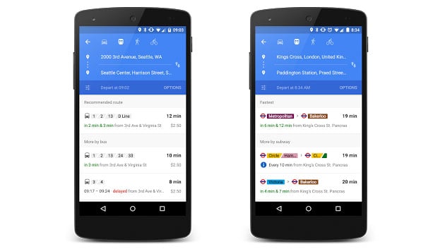
Yes, Google Maps has been providing users with transit information for a while. The only problem with the feature was that it would only give the public traditional schedules.
Now, if there are delays or routes are closed, Google Maps will let you know.
Google Maps is working with over 100 transit providers in addition to those in the UK, Netherlands, Budapest, Chicago, San Francisco, and Seattle so that you can receive live transit schedules right in Google Maps app.
Users will also receive real-time updates to their phone when the schedule changes.
Hopefully more cities and transit options will be added in the near future.