
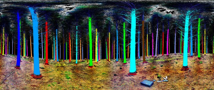
The European Space Agency’s 3D laser scanning system, supported by the Treemetrics company conducted forest mapping that resulted in this imagery.

An environmental and tree profiling company called Treemetrics wants to lower the rates of wasted forest resources so it collaborated with ESA’s Advanced Research in Telecommunications Systems (ARTES) programme’s Integrated Applications Promotion to integrate satellite communications into its system so that managers can monitor their equipment and track harvesting as it happens, even from remote forest locations.
With the help of the ESA’s Sentinel-1 and Sentinel-2, along with drone photography and laser radar (lidar), Treemetrics can perform forest mapping operations.
These maps are given a third dimension through ‘ground truthing’. Laser scanners perform a 360-degree survey at regular intervals to measure the straightness and health of trees – accurately estimating their quality as logs in advance of them being logged.
“What Treemetrics aims to deliver is more wood from fewer trees, through a complete end-to-end forest management system. It combines forest mapping, assessment and valuing with decision-making tools for harvest planning as well as real-time monitoring of the cutting and collecting process,”said Enda Keane, CEO of Treemetrics.
Story via ESA.